White Oak Profiler Data
Most Recent Observations
Select Date for Profile Graph
Refresh the page for updated data.
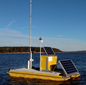
The Autonomous Vertical Profilers (AVPs) use a YSI Multi-Parameter Sonde to measure water temperature, salinity, pH, dissolved oxygen concentration, chlorophyll concentration, and turbidity from surface to bottom every 30 minutes. There is also an anemometer for wind speed and direction, and a consumer-grade depth sounder reporting water depth and surface temperature.
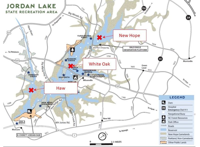
White Oak --- New Hope --- Haw River
White Oak Profiler - Recent Conditions
This page shows data acquired from the station located in the White Oak area of B. Everett Jordan Reservoir. Data are available in real-time upon collection. Wind and depth are averages taken every ten minutes. Profile images are updated every 30 minutes and can be reviewed by date using the calendar above. Profiler graphics are always in EST whereas the data in the table follows local time.
Here are some links to some USGS discharge data for above and below Jordan Lake: